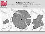
Where's Downtown? Varying Geographic Definitions of Winnipeg's Downtown and Inner City, 1947-2004
| dc.contributor.author | Werner, Adrian | |
| dc.contributor.author | McCullough, Scott | |
| dc.date.accessioned | 2016-07-27T16:22:58Z | |
| dc.date.available | 2016-07-27T16:22:58Z | |
| dc.date.issued | 2016-07-27 | |
| dc.identifier.uri | http://hdl.handle.net/10680/1212 | |
| dc.description | 19 pages: illustrations, maps; digital file. | en_US |
| dc.description.abstract | This series of maps was created to provide a basic overview of how downtown Winnipeg has been defined over time and by different organizations. These definitions of downtown were downloaded from the Manitoba Land Initiative and Open Data Winnipeg websites, given to us by members of the Winnipeg Data Consortium, or redrawn from maps in the Institute of Urban Studies Library and the Manitoba Historical Maps flickr page. | en_US |
| dc.language.iso | en | en_US |
| dc.publisher | Institute of Urban Studies | en_US |
| dc.rights | info:eu-repo/semantics/openAccess | |
| dc.subject | City planning -- Manitoba -- Winnipeg | en_US |
| dc.subject | Central business districts -- Manitoba -- Winnipeg | en_US |
| dc.subject | Manitoba -- Winnipeg | en_US |
| dc.subject | Inner cities -- Manitoba Winnipeg | en_US |
| dc.title | Where's Downtown? Varying Geographic Definitions of Winnipeg's Downtown and Inner City, 1947-2004 | en_US |
| dc.type | Map | en_US |
Files in this item
This item appears in the following Collection(s)
Related items
Showing items related by title, author, creator and subject.
-
Canadian healthy communities project : a conceptual model for Winnipeg
(Institute of Urban Studies, 1989-01-01)While in Canada health care falls in provincial jurisdiction, health itself is everyone's responsibility, and, it may be argued, particularly that of municipal government. Health, according to the World Health Organization ... -
Winnipeg's Vanishing Rooming Houses: Change in the West Broadway and Spence Neighbourhoods
(Institute of Urban Studies, 2014-06-24)