
Search
Now showing items 1-10 of 566
Automated Land Use and Land Cover Map Production: A Deep Learning Framework
(University of Winnipeg, 2018-10-19)
In this thesis, we present an approach to automating the creation of land use and land cover (LULC) maps from satellite images using deep neural networks that were developed to perform semantic segmentation of natural ...

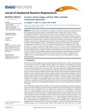
Temporal observations of bright soil exposures at Gusev crater, Mars
(Journal of Geophysical Research, 2011-01-27)
The Mars Exploration Rover Spirit has discovered bright soil deposits in its wheel tracks that previously have been confirmed to contain ferric sulfates and/or opaline silica. Repeated Pancam multispectral observations ...
Summer storms trigger soil N₂O efflux episodes in forested catchments
(American Geophysical Union, 2016-01-14)
Climate change and climate-driven feedbacks on catchment hydrology and biogeochemistry have the potential to alter the aquatic versus atmospheric fate of nitrogen (N) in forests. This study investigated the hypothesis that ...

Looking Not on His Picture, but His Books: Two New Histories of Folger’s Quest for First Folios Shed Unintended Light on the Authorship Question
(Shakespeare Oxford Fellowship, 2016-05)
A review of two recently-released books, The Millionaire and the Bard by Andrea Mays and Stephen Grant’s Collecting Shakespeare, both of which explore Henry and Emily Folgers’ shared obsession with collecting First Folios ...
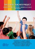
The Every Teacher Project on LGBTQ-inclusive Education in Canada's K-12 Schools: Final Report
(Manitoba Teachers’ Society, 2015)
This report presents the results of the online survey phase of the “Every Teacher Project” on Canadian K-12 educators’ perceptions and experiences of “LGBTQ-inclusive” education, including curriculum, policies, and practices ...

A Deep Learning Framework: Land-Use/Land-Cover Mapping and Analysis using Multispectral Satellite Imagery
(Springer, 2019-07-17)
In this article, we present an approach to land-use and land-cover (LULC) mapping from multispectral satellite images using deep learning methods. The terms satellite image classification and map production, although used ...

Estimating the Economic Cost of Obesity in Canadian Populations
(2016-08)
This study aims to provide a more complete description of who suffers most severely from obesity in terms of both the prevalence of the disease and its associated costs. Literature estimating the cost of obesity is often ...
"This course is like paying to volunteer" or is it? Effects of a mandatory service learning university course on pre-service teachers' civic attitudes
(Faculty of Education, McGill University, 2016)
One hundred teacher candidates enrolled in a mandatory course on service learning were surveyed pre- and post-course to determine their civic attitudes and willingness to take the service learning course. Quantitative ...
Passing the Buck? Examining Canadian Banks Approaches to Financial Exclusion
(Institute of Urban Studies, 2012-02-14)
The purpose of this report is to examine what Canadian banks say they are doing to address
financial exclusion by identifying what banks understand about its causes,
consequences, and solutions. Relevant bank-related ...