
Search
Now showing items 21-30 of 33
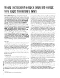
Imaging spectroscopy of geological samples and outcrops: Novel insights from microns to meters
(GSA Today, 2015-12-01)
Imaging spectroscopy is a powerful, non-destructive mineralogic tool that provides insights into a variety of geological processes. This remote measurement technique has been used for decades from orbital or aerial platforms ...
Physical characterization of ~2 m diameter near-Earth asteroid 2015 TC25: A possible boulder from E-type asteroid (44) Nysa
(The Astronomical Journal, 2016-11-11)
Small near-Earth asteroids (NEAs) (<20 m) are interesting, because they are progenitors for meteorites in our terrestrial collection. The physical characteristics of these small NEAs are crucial to our understanding of the ...
Temporal observations of bright soil exposures at Gusev crater, Mars
(Journal of Geophysical Research, 2011-01-27)
The Mars Exploration Rover Spirit has discovered bright soil deposits in its wheel tracks that previously have been confirmed to contain ferric sulfates and/or opaline silica. Repeated Pancam multispectral observations ...
Automated LULC Map Production using Deep Neural Networks
(Taylor & Francis, 2019-01-17)
This article presents an approach to automating the creation of land-use/land-cover classification (LULC) maps from satellite images using deep neural networks that were developed to perform semantic segmentation of natural ...
Submicroscopic metallic iron in lunar soils estimated from the in situ spectra of the Chang’E-3 mission
(Geophysical Research Letters, 2017-04-22)
Submicroscopic metallic iron (SMFe) created by space weathering has strong effects on the optical properties of the lunar surface. Spectra measured in situ by the visible-near-infrared spectrometer (VNIS) on board the ...
Summer storms trigger soil N₂O efflux episodes in forested catchments
(American Geophysical Union, 2016-01-14)
Climate change and climate-driven feedbacks on catchment hydrology and biogeochemistry have the potential to alter the aquatic versus atmospheric fate of nitrogen (N) in forests. This study investigated the hypothesis that ...
A Deep Learning Framework: Land-Use/Land-Cover Mapping and Analysis using Multispectral Satellite Imagery
(Springer, 2019-07-17)
In this article, we present an approach to land-use and land-cover (LULC) mapping from multispectral satellite images using deep learning methods. The terms satellite image classification and map production, although used ...
Visible/near-infrared spectral diversity from in situ observations of the Bagnold Dune Field sands in Gale Crater, Mars
(Journal of Geophysical Research: Planets, 2017-12-13)
As part of the Bagnold Dune campaign conducted by Mars Science Laboratory rover Curiosity, visible/near-infrared reflectance spectra of dune sands were acquired using Mast Camera (Mastcam) multispectral imaging (445–1013 ...
Intra-urban analysis of commercial locations: A GIS-based approach
(2013)
The urban landscape is an interspersed mixing of residences, shops, theatres, parks, natural areas, and a multitude of other uses. From the early days of the central markets, to the planned downtown, to the heavily planned ...